shape
carat
color
clarity

Storm Idalia

Thank you for taking the time to put these posts together @Arcadian. Thinking of you. Is there anything you can take to help your head?

Please stay safe everyone that is in the path of this storm. Thinking of you @tyty333, @elizat, @SandraLynn, @HS4S_2 and @Mayk

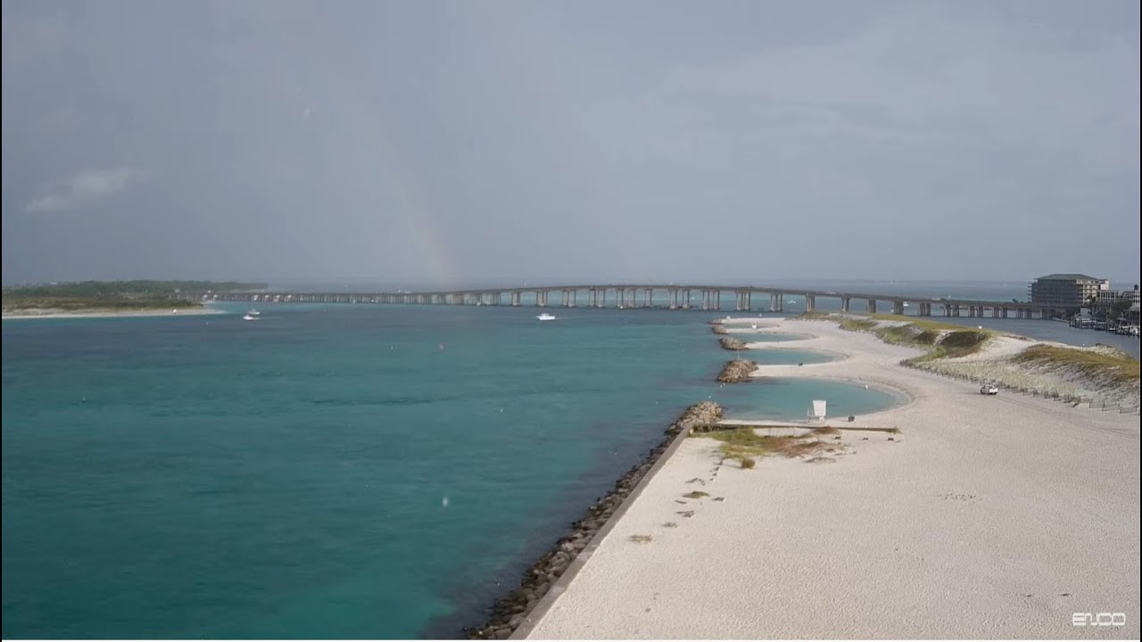
Tonight is another THC night. The continual pressure drops is absolutely heinous though.

For those who may be wondering. Franklin will be or I belive IS a major, Idalia is also very big and pressure is deepening.
2bigstorms.PNG

000

WTNT45 KNHC 282052
TCDAT5

Tropical Storm Idalia Discussion Number 9
NWS National Hurricane Center Miami FL AL102023
400 PM CDT Mon Aug 28 2023

The satellite presentation of Idalia has continued to improve this
afternoon. The center of the storm is embedded within an area of
deep convection with cloud tops colder than -75C. Although the
early reconnaissance aircraft and radar data from Cuba
have not yet indicated the presence of an eyewall, the aircraft
data did indicate that the pressure had fallen to around 987 mb on
the final pass through the center earlier this afternoon.

Believable SFMR winds of 60 kt were reported to the east of the
center, and Idalia's intensity was raised to that value on the
1800 UTC intermediate advisory and it remains at that value for
this advisory. NOAA and Air Force Reserve Hurricane Hunter aircraft
are scheduled to be in the storm environment again this evening and
should provide additional information on the structure and
intensity of the tropical cyclone. Another NOAA G-IV synoptic
surveillance mission is underway and that data should be
assimilated into the dynamical model runs this evening.

Idalia is moving northward or 360/7 kt. The storm should continue
to be steered northward between a mid-level trough over the central
Gulf of Mexico and a ridge near the Greater Antilles through
tonight. On Tuesday, a faster north-northeastward motion should
begin as a trough moves into the east-central United States. This
motion should bring the center of Idalia to the Gulf coast of
Florida on Wednesday. The dynamical models continue to have some
spread after 36 hours, with the GFS and HAFS guidance along the
western side of the envelope and the ECMWF along the eastern side.
The consensus aids were slightly west of the previous cycle, and
the NHC forecast has been nudged in that direction. The NHC track
forecast is in best agreement with the HFIP corrected consensus
model. It is still worth stressing that only a small deviation in
the track could cause a significant change in Idalia's landfall
location in Florida due to the paralleling track to the west coast
of the state. When Idalia nears the Atlantic coast of the
southeastern United States the guidance suggests the cyclone will
turn more eastward as the aforementioned trough passes to the north
of the storm.

The upper-level wind pattern is forecast to become more conducive
for significant strengthening when Idalia moves over the
southeastern Gulf of Mexico tonight and Tuesday. At the same time,
the storm is forecast to move over an area of high ocean heat
content. These conditions are likely to allow for a period of
rapid strengthening which is explicitly shown in the official
forecast through 36 hours. Idalia is likely to become a hurricane
this evening, and is predicted to become major hurricane over the
eastern Gulf within 36 hours.
The NHC intensity forecast is just a
little above the latest HFIP corrected consensus guidance.

Idalia is forecast to move into an area very susceptible to storm
surge, and regardless of the cyclone's landfall intensity, there is
increasing confidence of a significant storm surge event.


KEY MESSAGES:

1. There is a danger of life-threatening storm surge inundation
along portions of the Florida Gulf Coast where a Storm Surge Warning
is in effect, including Tampa Bay and the Big Bend region of
Florida. Inundation of 8 to 12 feet above ground level is expected
somewhere between Chassahowitzka and Aucilla River. Residents in
these areas should follow any advice given by local officials.

2. Hurricane conditions are expected within portions of the
Hurricane Warning area along the Florida Gulf Coast, with the
potential for destructive winds where the core of Idalia moves
onshore. Strong winds will also spread inland across portions of
northern Florida near the track of the center of Idalia.

3. Areas of flash and urban flooding, some of which may be locally
significant, are expected across portions of the west coast of
Florida, the Florida Panhandle, and southern Georgia Tuesday into
Wednesday, spreading into portions of the eastern Carolinas
Wednesday into Thursday.

4. Hurricane-force winds are expected across portions of far western
Cuba tonight. Heavy rainfall is also expected across portions
of western Cuba and may produce areas of flash and urban
flooding as well as landslides.


FORECAST POSITIONS AND MAX WINDS

INIT 28/2100Z 21.4N 85.1W 60 KT 70 MPH
12H 29/0600Z 22.7N 85.2W 75 KT 85 MPH
24H 29/1800Z 24.9N 85.0W 90 KT 105 MPH
36H 30/0600Z 27.6N 84.4W 105 KT 120 MPH
48H 30/1800Z 30.4N 82.9W 80 KT 90 MPH...INLAND
60H 31/0600Z 32.7N 80.4W 50 KT 60 MPH...INLAND
72H 31/1800Z 34.0N 76.8W 50 KT 60 MPH...OVER WATER
96H 01/1800Z 34.1N 71.4W 45 KT 50 MPH
120H 02/1800Z 34.0N 69.0W 45 KT 50 MPH

$$
Forecaster Brown
 
They say New Yorkers are tough, but I think you Floridians are tougher.
All this and alligators too. :shock:
 
Well, Im definitely not going to work Wednesday. A nice three day vacation for me.
 
There's a lot of people from all over. I think one has to have a certain mindset to live here though. And maybe be a little crazy considering you're living on a kinda sorta sinking sandbar.

The US has some very violent weather. I've lived in places that had blizzards, dust storms, earthquakes, tornadoes, and crazy weather swings. I just haven't had to deal with lava yet.

So maybe we're all a little nuts, but, we have to live somewhere.

Idalia became a hurricane last night at the 11pm update and there's a track move to the west.
093743_5day_cone_no_line_and_wind.png

Today will be the last round of updates, after that no model is going to make any sense. I'll post whatever video feeds I can (most will be highway or county.

Also air recon will be ongoing today


000
WTNT45 KNHC 290859
TCDAT5

Hurricane Idalia Discussion Number 11
NWS National Hurricane Center Miami FL AL102023
400 AM CDT Tue Aug 29 2023

Radar data from western Cuba indicates that Idalia is becoming
better organized. Most of an eyewall has formed, with much more
curvature in the banding features and overall radar pattern.

Satellite imagery also shows the center of Idalia firmly within the
central dense overcast. Thus, the initial wind speed is raised to
65 kt, in accordance with the latest TAFB satellite classification.

The hurricane is accelerating northward this morning, now moving at
about 9 kt. Idalia should move faster to the north or
north-northeast through landfall on Wednesday between mid-level
ridging over Florida and a trough dropping into the western Gulf of
Mexico.
There has been a westward shift in the model guidance
overnight, perhaps due to the trough tugging Idalia more
northward before taking a north-northeast turn. It should be
noted that the ECMWF ensemble shows many of its strongest members
on the eastern side of its guidance envelope, which is a
reasonable place to be given the synoptic pattern. The new NHC
forecast is adjusted a little to the west but is now east of the
model consensus on the eastern side of the reliable model guidance.
After Idalia leaves the eastern United States coastline, the track
forecast becomes highly uncertain and little change was made to the
previous forecast.

With an inner core now present, the stage is set for Idalia to
rapidly intensify before landfall.
Shear should continue to lower
over the cyclone as an upper-level trough departs the northeastern
Gulf of Mexico and ridging builds closer to the cyclone. These
changes, combined with extremely warm and deep waters the hurricane
will be traversing, all strongly point to rapid intensification.
The new forecast is similar to the previous one, and confidence is
increasing in an extremely dangerous major hurricane making landfall
Wednesday along the west coast or Big Bend region of Florida.


KEY MESSAGES:

1. There is a danger of life-threatening storm surge inundation
along portions of the Florida Gulf Coast where a Storm Surge Warning
is in effect, including Tampa Bay and the Big Bend region of
Florida. Inundation of 8 to 12 feet above ground level is expected
somewhere between Chassahowitzka and Aucilla River. Residents in
these areas should follow any advice given by local officials.

2. Hurricane conditions are expected within portions of the
Hurricane Warning area along the Florida Gulf Coast, with the
potential for destructive winds where the core of Idalia moves
onshore. Strong winds will also spread inland across portions of
northern Florida near the track of the center of Idalia.

3. Heavy rainfall is expected across portions of western Cuba and
may produce areas of flash and urban flooding as well as landslides.
Areas of flash and urban flooding, some of which may be locally
significant, are expected across portions of the west coast of
Florida, the Florida Panhandle, and southern Georgia beginning today
into Wednesday, spreading into portions of the eastern Carolinas
Wednesday into Thursday.


FORECAST POSITIONS AND MAX WINDS

INIT 29/0900Z 23.1N 85.0W 65 KT 75 MPH
12H 29/1800Z 24.9N 84.8W 85 KT 100 MPH
24H 30/0600Z 27.8N 84.3W 105 KT 120 MPH
36H 30/1800Z 30.6N 82.9W 70 KT 80 MPH...INLAND

48H 31/0600Z 32.7N 80.5W 50 KT 60 MPH...INLAND
60H 31/1800Z 33.8N 77.5W 50 KT 60 MPH...OVER WATER
72H 01/0600Z 33.9N 74.4W 50 KT 60 MPH
96H 02/0600Z 33.3N 71.5W 45 KT 50 MPH
120H 03/0600Z 32.5N 70.5W 40 KT 45 MPH

$$
Forecaster Blake
 
Currently in South Florida the winds are gusty, its sunny, its quite hot with a feels like temp of 106. The storm is moving quite fast right now and anyone wanting to evacuate at the coast, should.

Lot of oak and pine trees in Northern FL/GA/SC/NC which is worrisome.


259
WTNT45 KNHC 291454
TCDAT5

Hurricane Idalia Discussion Number 12
NWS National Hurricane Center Miami FL AL102023
1100 AM EDT Tue Aug 29 2023

WSR-88D radar data from Key West shows that Idalia's eye is
becoming better defined at an elevation of 30,000 feet, although an
eye has not yet become apparent in visible satellite imagery. A
NOAA Hurricane Hunter aircraft reported a closed eye 20-25 n mi in
diameter, SFMR winds as high as 70 kt, and a central pressure down
to 976 mb.
This pressure, and assuming some undersampling of the
SFMR, supports an initial intensity of 75 kt.

Idalia is moving just east of due north, or 005/12 kt, between a
mid-level trough over the Gulf of Mexico and subtropical ridging
over the Greater Antilles. A faster motion toward the north or
north-northeast is expected while Idalia approaches the Florida
coast through Wednesday morning. Confidence is increasing that
Idalia will reach the coast of Florida adjacent to Apalachee Bay
Wednesday morning, with all of the reliable deterministic track
models honed in on that area.
Track spread remains low during
Idalia's expected turn toward the northeast and east-northeast in
48-60 hours, bringing the storm's center near or along the coast of
the Carolinas. On days 3 through 5, there is significant
uncertainty on whether Idalia will turn out to sea (as shown by the
COAMPS-TC and HAFS models) or turn southward (as suggested by the
global models). For now, the official forecast shows a slow motion
at the end of the forecast period until the scenario becomes
clearer.

Idalia is currently over a maximum of oceanic heat content
associated with the Loop Current, and water temperatures remain
30-31 degrees Celsius along the forecast path up until landfall.
Vertical shear is also expected to be low for the next 18-24 hours,
and these conditions are expected to foster rapid intensification
before Idalia reaches the coast of Florida.
The 06 UTC runs of all
4 regional hurricane models (HAFS-A, HAFS-B, HWRF, and HMON) show
Idalia potentially reaching an intensity of 110-120 kt in 24 hours,
and as a result, the new NHC intensity forecast indicates a peak
intensity of 110 kt just before landfall. Weakening is forecast
while the center of Idalia moves over land, but the system is
expected to be a tropical storm while it moves near or along the
coasts of Georgia and the Carolinas through Thursday.


KEY MESSAGES:

1. Catastrophic impacts from storm surge inundation of 10 to 15 feet
above ground level and destructive waves are expected somewhere
between Aucilla River and Yankeetown, Florida. Life-threatening
storm surge inundation is likely elsewhere along portions of the
Florida Gulf Coast where a Storm Surge Warning is in effect.
Residents in these areas should follow any advice or evacuation
orders given by local officials.

2. There is the potential for destructive life-threatening winds
where the core of Idalia moves onshore in the Big Bend region of
Florida, with hurricane conditions expected elsewhere in portions of
the Hurricane Warning area along the Florida Gulf Coast. Strong
winds will also spread inland across portions of northern Florida
and southern Georgia near the track of the center of Idalia where
Hurricane Warnings are in effect. Residents in these areas should be
prepared for long-duration power outages.

3. Areas of flash and urban flooding, some of which may be locally
significant, are expected across portions of the west coast of
Florida, the Florida Panhandle, and southern Georgia Tuesday into
Wednesday, spreading into portions of the eastern Carolinas
Wednesday into Thursday.

4. Heavy rainfall from Tropical Storm Idalia is expected across
portions western Cuba and may produce areas of flash and urban
flooding as well as landslides.


FORECAST POSITIONS AND MAX WINDS

INIT 29/1500Z 24.6N 84.8W 75 KT 85 MPH
12H 30/0000Z 26.5N 84.6W 90 KT 105 MPH
24H 30/1200Z 29.3N 83.7W 110 KT 125 MPH
36H 31/0000Z 31.8N 81.7W 55 KT 65 MPH...INLAND

48H 31/1200Z 33.5N 78.8W 45 KT 50 MPH...OVER WATER
60H 01/0000Z 34.1N 75.6W 45 KT 50 MPH
72H 01/1200Z 33.8N 73.0W 45 KT 50 MPH
96H 02/1200Z 32.5N 70.2W 45 KT 50 MPH
120H 03/1200Z 32.0N 68.8W 45 KT 50 MPH

$$
Forecaster Berg
 
Yes @Arcadian I am in that county. I heard we are under tropical storm warnings but no evacuations. I've been out on
the road this morning and everything seems normal...usually a lot more traffic if people are worried. I'm not worried about
us or lower on the East Coast...more so for Jacksonville.

I am worried about the west coast. My parents are up in Gainesville at an appointment. Wish they would finish up and get
back home.

Everyone stay safe out there!
The cone has narrowed a lot as things are honed in which is great, but still a really wide storm (500+ miles wide?) so as it comes through the coastal areas are going to catch the onflow on the east side.


Thats the only thing I can think of why you guys are under.
 
These are all videos that I could find

Siesta Beach

Pelican Pete St. Petersburg

Clearwater Live Cam

St. Augustine


Mirabella Perdido Key, FL
https://www.youtube.com/watch?v=pY1Ui7R26dQ


Key west

https://www.youtube.com/watch?v=qkaqbFXTe34

https://www.youtube.com/watch?v=5P62Nv_0vI8

https://www.youtube.com/watch?v=-hGxbIZxZxk

https://www.youtube.com/watch?v=Oi8s8E5ocw8

Cape Coral
https://www.youtube.com/watch?v=p3AB2dxXH6I

University of Tampa Live Cam
https://www.youtube.com/watch?v=qYs-SMoyH_k

Destin Bridge Webcam


News Chanel 7 SWFL
https://www.youtube.com/watch?v=XObsOutMlh8
 
We're getting wind, rain, and lightning...schools are closed for tomorrow.
 
HI:

Stay safe peeps!!!! Refuse ALL sharknado's!!!

cheers--Sharon
 
My dogs are being absolutely ridiculous and my head is banging so freaking hard. We're having bands go through that are massively strong:shock: considering its nowhere near us.

They get some very nice calming drugs this evening and so will I!

Basically at this point things are set in stone. the storm is moving really fast right now at 16mph. There are still Recon missions out there because the pressure is dropping (968MB right now...ugh!!!)


You guys please stay safe tomorrow is going to be a MFer for some.
 
I just saw the National Hurricane Center said “Don’t mess with this one”. Stay safe Florida friends!
 
DANG!

Friggin Climate Change! :angryfire::angryfire::angryfire::angryfire::angryfire:
 
Thanks to @Arcadian for these wonderful, detailed updates. I do not live in Florida but for our members that do, this has to be very informative. You give a lot of your time to this and you are to be commended! Hope your head pressure abates soon too!!
 
Storm is now a cat 4. It wasn't predicted to be this strong but here we are. eyewall replacement is happening and it will hit about 8am.


This is mainly for Georgia/SC/NC If you're anywhere near this thing, if they say evacuate, do it. This is not messing around. If you can't leave, hunker down and stay safe.
093940_5day_cone_no_line_and_wind.png

Its moving very fast and is almost school zone illegal. (thats the only good part of this thing) The eyewall is TINY, but thats what can make a hurricane really really strong sometimes.

The one thing to pay attention to is all the winds this thing has. its got a very big wind field

093940.png

270
WTNT45 KNHC 300857
TCDAT5

Hurricane Idalia Discussion Number 15
NWS National Hurricane Center Miami FL AL102023
500 AM EDT Wed Aug 30 2023

Idalia continues to undergo rapid intensification. Maximum
flight-level winds were 123 kt, with believable SFMR values of 115
kt. Satellite images show a small eye surrounded by very cold
clouds tops, especially in the western quadrant. The initial wind
speed is set to 115 kt, making Idalia an extremely dangerous
category 4 hurricane.

The hurricane still has a few hours left to intensify before it
makes landfall. The biggest change to the intensity forecast is to
increase the wind speeds over southeastern Georgia and South
Carolina as the rapid motion and track close to the coast is
expected to keep the system near hurricane strength for longer.

Thus a Hurricane Warning has been issued for a portion of those
coasts, and the Hurricane Watch is extended northeastward. After
the hurricane moves offshore, the wind field on the northwestern
side near eastern North Carolina is expected to be enhanced by a
cold front, and the Tropical Storm Watch has been upgraded to a
Tropical Storm Warning in that area. The long-range intensity
forecast is quite uncertain with Idalia taking on some hybrid
characteristics due to a baroclinc trough. No changes were made at
this time, and the forecast remains close to the consensus.

Idalia is moving faster toward the north-northeast or 025/16 kt.
After landfall, Idalia is expected to move near or along the coast
of Georgia and the Carolinas in 24-36 hours. Uncertainty in the
track forecast beyond 48 hours remains quite large, and the latest
guidance is significantly faster. The new forecast is adjusted
toward the consensus, but could be too slow at long range.


KEY MESSAGES:

1. Catastrophic impacts from storm surge inundation of 12 to 16 feet
above ground level and destructive waves are expected somewhere
between the Wakulla/Jefferson County line and Yankeetown, Florida.
Life-threatening storm surge inundation is likely elsewhere along
portions of the Florida Gulf Coast where a Storm Surge Warning is in
effect. Residents in these areas should follow any advice given by
local officials.

2. Destructive life-threatening winds will occur where the core of
Idalia moves onshore in the Big Bend region of Florida, with
hurricane conditions expected elsewhere in portions of the Hurricane
Warning area along the Florida Gulf Coast. Strong winds will also
spread inland across portions of northern Florida and southern
Georgia near the track of the center of Idalia where Hurricane
Warnings are in effect. Residents in these areas should be prepared
for long-duration power outages. Damaging hurricane-force winds are
likely in portions of eastern Georgia and southeastern South
Carolina where Hurricane Warnings are now in effect.

3. Areas of flash, urban, and moderate river flooding, with
considerable impacts, are expected from the Florida Big Ben through,
central Georgia and South Carolina, through eastern North Carolina
into Thursday.


FORECAST POSITIONS AND MAX WINDS

INIT 30/0900Z 29.1N 84.1W 115 KT 130 MPH
12H 30/1800Z 31.0N 82.7W 85 KT 100 MPH...INLAND
24H 31/0600Z 33.1N 79.6W 60 KT 70 MPH...INLAND
36H 31/1800Z 33.8N 76.1W 50 KT 60 MPH...OVER WATER

48H 01/0600Z 33.3N 72.7W 50 KT 60 MPH
60H 01/1800Z 32.4N 70.7W 45 KT 50 MPH
72H 02/0600Z 31.5N 69.5W 45 KT 50 MPH
96H 03/0600Z 30.7N 68.0W 45 KT 50 MPH
120H 04/0600Z 30.5N 66.0W 45 KT 50 MPH

$$
Forecaster Blake
 
Thanks to @Arcadian for these wonderful, detailed updates. I do not live in Florida but for our members that do, this has to be very informative. You give a lot of your time to this and you are to be commended! Hope your head pressure abates soon too!!

Last night was pretty freaking bad. This A.M. I feel it still not as bad as yesterday. I have another few days of headaches it seems.
 
Eye came on shore as a very strong cat 3 but there's still a ways to go. water is still rising in a lot of spots that was hit yesterday.
 
@Arcadian: please check in. Your silence is concerning. Maybe you've lost power?
 
we are ok in North Myrtle Beach, still windy, rainy and chilly, they had flooding and I guess a water spout or tornado hit a couple of houses, we never lost power in the condo we are staying in, the water came up to the dunes but didn't go over them, we are on the 14th floor and oceanfront, my SUV was on the 5th floor of a parking garage...we will be heading out here a little later for a wine tasting...so we shall see whats out there...hope everyone else is ok!
 
@Arcadian: please check in. Your silence is concerning. Maybe you've lost power?
newstorms.PNG

I got some sleep...lol I actually did fine, the west coast though... its unreal. its very bad on that side of the state. Cedar Key where the eye came ashore took on a ton of damage.

Idalia is still a tropical storm.

090744_5day_cone_no_line_and_wind.png

00
WTNT45 KNHC 310843
TCDAT5

Tropical Storm Idalia Discussion Number 19
NWS National Hurricane Center Miami FL AL102023
500 AM EDT Thu Aug 31 2023

Surface observations from around 0600 UTC showed that the center of
Idalia moved offshore of the coast of northeastern South Carolina.
Strong southwesterly vertical wind shear has displaced the deep
convective bands and heavy rainfall well north and northeast of the
center over eastern North Carolina and the adjacent Atlantic. A
partial ASCAT-B overpass over the southeastern portion of the
circulation revealed winds of 40-45 kt and given that instrument's
typical undersampling, the initial wind speed is maintained at
50 kt for this advisory.

Idalia has turned east-northeastward between a mid-level
anticyclone over the Bahamas and a mid-tropospheric trough moving
eastward over the northeastern United States. The anticyclone is
forecast to retrograde over Florida during the next couple of days,
causing Idalia to turn east-southeastward tonight and Friday.
After that time, steering currents are predicted to weaken and the
cyclone is expected to move very slowly to the southwest of
Bermuda during the weekend.
By early next week, another
mid-latitude trough moving off the northeast U.S. coast should
cause Idalia to begin moving northeastward, however there is still
significant uncertainty in the details of the track forecast
later in the period.

Little change in strength is predicted today, but strong
upper-level winds and drier mid-level air are likely to cause some
gradual weakening by the weekend.
Simulated satellite imagery from
the GFS and ECMWF models suggest that the system could lose
organized deep convection as soon as tonight, and Idalia could
degenerate into a post-tropical cyclone in a day or so. However,
the ECMWF does show a return of deep convection over the weekend so
the official forecast continues to retain the system as a tropical
storm throughout the foreast period.


KEY MESSAGES:

1. Areas of flash, urban, and moderate river flooding, with
considerable impacts, will continue across coastal North Carolina
through today.

2. Coastal flooding is expected within the Storm Surge Watch
area in North Carolina today. Residents in these areas should
follow any advice given by local officials.

3. Tropical storm conditions are expected in northeastern South
Carolina and portions of eastern North Carolina today.


FORECAST POSITIONS AND MAX WINDS

INIT 31/0900Z 33.6N 78.0W 50 KT 60 MPH
12H 31/1800Z 34.0N 75.1W 50 KT 60 MPH
24H 01/0600Z 33.5N 71.7W 45 KT 50 MPH
36H 01/1800Z 32.4N 69.1W 45 KT 50 MPH
48H 02/0600Z 31.5N 68.0W 40 KT 45 MPH
60H 02/1800Z 31.2N 67.5W 40 KT 45 MPH
72H 03/0600Z 31.4N 66.6W 40 KT 45 MPH
96H 04/0600Z 33.1N 63.8W 40 KT 45 MPH
120H 05/0600Z 35.6N 61.4W 45 KT 50 MPH

$$
Forecaster Brown
 
GET 3 FREE HCA RESULTS JOIN THE FORUM. ASK FOR HELP
Top